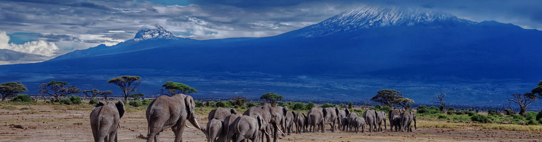
Kilimanjaro National Park
In 1910 the area was declared as a game reserve and a forest reserve in 1921 before being gazetted as a national park in 1973. It was not until 1977 that Kilimanjaro was opened for public access. The park was declared by UNESCO as a world heritage site in 1987 and voted as one of the Seven Natural Wonders of Africa in 2013. Kilimanjaro is located in Northern Tanzania 48 km from Moshi town and covers an area of 1,668 square km.
- How to get there
By road:123 km, a two-hour drive from the city of Arusha or 48 km, an hour drive from Moshi town to Marangu Gate, and 86km one hour and a half drive from Kilimanjaro International Airport.
- The best time to visit
Mountain climbing can be done throughout the year. However, the best time is mid-June-October and December-mid March.
- Tourism activities
Mountain climbing –Climbing Kilimanjaro is not just a climb but a journey from the tropics to the Arctic. The higher you climb, the colder it gets with changes in vegetation zones.
Mount Kilimanjaro climbing routes
| Route/days | 1 | 2 | 3 | 4 | 5 | 6 | 7 | 8 | |
| Rongai | Option 1 | rongai gate to simba camp | 3rd Cave | School/Kibo huts | Kibo/School hut to Uhuru then to Horombo hut | Horombo to Marangu gate | – | – | – |
| Option 2 | Rongai gate to simba camp | Simba to Kikelelwa | Kikelelwa to Mawenzi Tarn hut | Mawenzi tarn hut to Kibo | Kibo to Uhuru then Horombo hut | Horombo hut to Marangu gate | – | – | |
| Marangu | Option 1 | Marangu gate to Mandara | Mandara to Horombo | Horombo to Kibo | Kibo to Uhuru then to Horombo | Horombo to Marangu gate | – | – | – |
| Option 2 | Marangu gate to Mandara | Mandara to Horombo | Stay at Horombo | Horombo to Kibo | Kibo to Uhuru then to Horombo | Horombo to Marangu gate | – | – | |
| Umbwe | Option 1 | Umbwe gate to Umbwe cave | Umbwe cave to Baranco camp | Baranco to Karanga camp | Karanga to Barafu camp | Barafu to Uhuru then to Mweka hut | Mweka hut to Mweka gate | – | – |
| Option 2 | Umbwe gate to Umbwe cave | Umbwe cave to Baranco camp | Baranco to Lava Tower camp | Lava Tower to Uhuru then to Mweka hut | Mweka hut to Mweka gate | – | – | – | |
| Machame | Option 1 | Machame gate to Machame hut | Machame hut to Shira II camp | Shira II to Baranco camp | Baranco to Barafu Camp | Barafu to Uhuru then to Mweka hut | Mweka hut to Mweka gate | – | – |
| Option 2 | Machame gate to Machame hut | Machame hut to Shira II camp | Shira II to Baranco camp | Baranco to Karanga Camp | Karanga to Barafu camp | Barafu to Uhuru then to Mweka hut | Mweka hut to Mweka gate | – | |
| Option 3 | Machame gate to Machame hut | Machame hut to Shira II camp | Shira II to Lava Tower camp | Lava Tower to Uhuru peak | To Uhuru peak to Mweka hut | Mweka hut to Mweka gate | – | – | |
| Londorosi/Lemosho | Option 1 | Starting to Mti Mkubwa camp | Mti Mkubwa to Shira I camp | Shira I to Shira II or Moir hut camp | Shira II/ Moir Hut to Lava Tower then Baranco Camp | Baranco to Karanga Camp | Karanga to Barafu camp | Barafu to Uhuru then to Mweka hut | Mweka hut to Mweka gate |
| Option 2 | Londorosi gate to Shira I | Shira I to Shira II or Moir hut camp | Stay Shira II (optional) | Shira II to Lava Tower then Baranco Camp | Baranco to Karanga Camp | Karanga to Barafu camp | Barafu to Uhuru then to Mweka hut | Mweka hut to Mweka gate
| |
Nature Walking safari – Short walking safari
- Marangu via Lauwo waterfall to Mandara (12Km)
- Machame gate to Machame hut (11Km)
- Morum barrier to Shira I (06Km)
- Rongai gate to simba camp (05Km)
(refer to walking safari guidelines)
Nature walk to Lauwo waterfall Marangu (2.8Km from the gate)
No additional fees for this activity apart from daily conservation fees:
- Birding:
There are about 179 bird species inhabiting different vegetation zones, thus giving an opportunity to view them in different climatic zones. Birds like White Necked Raven, Lammergeyer, and Alpine Chat are commonly seen in high-altitude zones.
Alpine Chart Bar Long-Tailed Trogon White nacked Raven
- Camping:
There are 31 camping sites along the seven hiking routes: Off all the camping sites are wilderness with toilets and a park staff house
* Londorosi Route
This is an ascending route located on the western side of the mountain and it comprises five stations namely Shira I, Shira II, Baranco, Karanga, and Barafu. It also offers the chance to use the Northern circuit and Western breach.
* Lemosho route
This route is also for ascending located on the western side of the mountain and it is comprised of six stations of Mti Mkubwa then joins the Londorosi route at Shira I.
* Machame route
This is an ascending route as well located on the southwest of the mountain and it has five stations namely Machame Hut, Shira Cave, Baranco, Karanga, and Barafu.
* Umbwe route
It is an ascending route located on the southwest of the mountain and it has four stations, the Umbwe cave inside the forest belt and the other three after joining the Machame route at Baranco camp.
* Mweka route
This is a descending route located on the southern side of the mountain. It comprised three stations namely Mweka Hut, High Camp (Millenium), and Barafu. Visitors from Londorosi, Lemosho, Machame, and Umbwe descent using this route
* Kilema route
This route is for cycling. It has three stations namely Kilemamchele, Maua, and Kibo; it is two-way traffic.
* Marangu route
This route is for ascending and descending with the provision of huts along the trail. It has three stations namely Mandara, Horombo, and Kibo.
On the mountain stations, there are toilets, kitchens, dining, and rooms for clients. Booking through a licensed mountain tour operator is mandatory.
* Rongai Route
It is an ascending route with an option of using four or five stations depending on the choice of the climber. Visitors who ascend through this route will descend through Marangu route. Option four stations include Simba camp, second cave, third cave, and school hut and the second option for five stations is Simba camp, second cave, Kikelelwa, Mawenzi tarn hut, and School hut.
Additional fees apart from the conservation fees
| Category | Public campsite fee | |
| Adult | Child(>16 years) | |
| Non-EAC Citizens/ TZ Expatriates | US $ 50 | US $ 10 |
| EAC Citizens | TZS 10,000 | TZS 5,000 |
Setting a camp at a public campsite
- Cycling
Kilema route takes you to the highest point in Africa while cycling. This route has three stations of Kilimamchele (9km), Maua 12km and kibo 21km from Kilema gate. Also there is a non summit bound route/circuits totaling 44.3Km in shira plateau were one can have an itinerary of one to four days depending on their time and budget.
Additional fees apart from the conservation fees
| Category | Cycling |
| Non EAC Citizens/ Tz Expatriates | US $ 50 |
| EAC Citizens | TZS 30,000 |
Cyclers exploring the saddle area of the highest mountain in Africa
(Refer to cycling guidelines)
- Paragliding:
The launching area on the mountain is explored by the operator similarly the landing site in or outside the park
Additional fees apart from the conservation fees
| Category | Paragliding |
| Non EAC Citizens/ Tz Expatriates | US $ 200 |
| EAC Citizens | TZS 100,000 |
Wing suiting from the roof of Africa
(Refer to paragliding guidelines.)
- Filming:
Kilimanjaro, the highest free-standing mountain, not only attracts climbers but also professional filmers. The famous film, “The Snows of Kilimanjaro (1952)” centered on Ernest Hemingway’s work that also won two Oscars at the 25th Academy Awards was shot from this park.
Filming fee: US $250 charged per person/day and covers conservation, camping, and filming fees. This applies to all nationalities.
(Refer filming guidelines)
- Picnicking: There are total of 13 picnic sites along the hiking routes (Rongai starting, Kisambioni, Lauwo, wona, last water, jiwe la ukoyo, Machame half way, Jiwe la mbula, Baranco junction, morum, uwanja wa ndege, mgongo wa tembo, daraja refu, Kilimamchele) that offer a spectacular view of the attractions found in and outside the park. They are best places for taking packed meals on your way to the roof of Africa.
- Tourist attractions
1. Three peaks
Kibo, the highest peak (5,895m), is covered by snow throughout the year despite being close to the equator. Conquering this peak is an adventure of a lifetime.
Mawenzi, the rugged peak (5,149m), can only be attempted by technical climb. Only people with specialized knowledge, skills, and equipment are allowed.
Shira Peak, (3962) is the oldest peak that collapsed some 750 years ago while before collapsing was the highest of the three.
The collapsed Shira peak
2. Shira Plateau
After collapsing, the Shira Peak formed a plateau of outstanding scenic beauty on the mountain. This plateau has an open grassland, heath, and moorland with a large concentration of endemic plants including Senecio and lobelias. While on the plateau, one can visit the Shira central cone, the Cathedral, and the Needle. Several kinds of migratory mammals such as buffaloes, elephants, and elands use this plateau for feeding or salt licking.
3. Montane Forest
It’s in this area, one finds the largest known population of Abbot’s duiker and various plant species, including endemic plants like Impatiens Kilimanjaro. Walking through this belt takes one’s breath away.
Hiking trail in the midlist of the pristine montane forest
- Accommodation
Marangu route: The “A” shaped huts in Mandara, Horombo, and Kibo (these need reservation well in advance) provide a unique life time adventure during the hike. Apart from the huts, there are 29 public camping sites in the wilderness zones which increase visitors experience in exploring the hidden beauty of the mountain. In these campsites, visitors carry their own tents as there is only provision of toilets in these camps. Also, there is a hostel facility at the park headquarters (Marangu) which can be booked in advance.
Before or after the climb, visitors can be accommodated in several hotels in the Marangu area, Kibosho, Moshi, Machame area, and Arusha town. Prior reservations (through Tour Operator) are often necessary.
Horombo huts at Marangu route (3720M) provide a wonderful night stay along the Marangu route
Please love nature and love life observe the following:-
• Do not litter
• Do not kill, harass, disturb, or feed any wild animals in the Park
• Do not enter the park without a valid permit
• Do not ignite wildfires
• Do not erect, mark, or remove any signboard in the Park
• Do not enter or leave the Park at points other than the official entry/exit gates stipulated in your permit.
• Children under 10 years of age are not allowed to go above 3700m above sea level
• Provide adequate and correct registration particulars for our records
• Hike and camp at the designated trail and campsites only
• Every climbing group must be led by a trained guide. Feel free to ask the guide for his / her official guiding ID issued by the park
• Use available toilet/ablution facilities
• Porters shall carry a maximum of 25kgs [including their belongings]
• Any kind of weapon/ammunition is strictly prohibited in the park
Climbing Tips
• Observe and adhere to all park rules and regulations
• Climbers are advised to have appropriate climbing gears
• Allow plenty of time for the body to acclimatize by ascending slowly
• Do not push yourself up the mountain if your body is exhausted or you have an extreme mountain sickness
• Drink 4 – 5 liters of fluid each day. Water is the best but fruit juices are a good supplement
• If symptoms of mountain/high altitude sickness persist please descend immediately and seek medical treatment. Our rescue team is always on standby for evacuation to nearby hospitals.
OUR CUSTOMERS RECOMMEND ELIA SAFARIS


